Let’s head southwest to the Kerry Peninsula where our first stop is in Killarney to check out 15th century Ross castle. If you like, pay the entrance fee and tour inside.


Notice the steps down to the lake where a short boat trip takes us to the holy island of Innisfallen. The monastery, built in the 7th century by St. Finian the Leper, was sacked many times by the Vikings, rising each time from destruction. Most of the ruins seen today are from the 12th century.


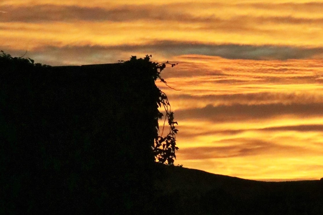
Afterwards, drive towards Cahirsiveeen with beautiful Dingle bay on the right hand side. If you pre-plan, you’ve packed a picnic lunch to enjoy at one of the scenic overlooks. Our final destination will be Ballinskelligs–with cinema worthy beaches, amazing restaurants close by and live music in many o’pub. Stay with perfect hosts, Dom and Lillian at the old school house for great digs and the best breakfast in Ireland. The feature sunset photo was taken in their backyard. https://www.rascalstheoldschoolhouse.com/
Bolus Loop Walk –Ballinskelligs
7.5 km and allow 2.5 hours. This fantastic trail starts at the car park where there’s a monument to Americans who crashed an airplane into the ocean during WWII.


Walk along the country road, arriving at a short ladder into the field and keep following the purple sign markers. Slowly climb the ridge, with views across the Atlantic ocean to Skelling Michael.  Moderate trek, steady uphill with beautiful views. Oh—and don’t miss the Skellig chocolate factory after you’re done hiking. Definelty worth a stop! https://www.irishtrails.ie/trail/Bolus-Barracks-Loop/612/
Bentee Loop
Cahirsiveen
This 9 mile, moderate trail is worth every drop of sweat up “the mountain of the cross”. We started behind the gas station in Cahirsiveen, following the purple signposts to an overlook of the city for fantastic views east as well as back toward town.  Continuing on the loop, there’s some shade while walking south until the track switches uphill and heads west.


")

The view at the summit is breathtaking, looking down upon Cahirsiveen, over to Portmagee,Valencia Island and to lands beyond. On a clear day, you really can see forever.


One note on the descent: about a third of the way down the hill, you’ll come to TWO purple sign markers. One heads straight downhill; the other cuts diagonally left toward the west. We couldn’t see any landmarks to help make an educated guess on which path to take and there wasn’t a trail map at that juncture. Suffice it to say that we think we took the wrong route since it took us so long to get back to town. Taking all in stride, we still found ways to entertain ourselves. The reward on a hot day was ice cream back at our starting point.


https://www.irishtrails.ie/Trail/Cahersiveen—Beentee-Loop/
Gorgeous Ladies Beach, AKA: Ballinskelligs Beach
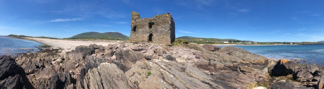
Fabulous beaches are a well-kept secret in Ireland and Ballinskelligs has more than its share of powdery sand leading to turquoise seas. This one is special, because it comes with its own tower castle, McCarthy Mor, dating to the 15th or 16th century.


Wait! It gets better. Farther down the beach there are more ruins of a monastery, church, and graveyard. Monks abandoned Skellig Michael in the 12th century (more on the reason in the next post) and settled in this location.


The half-moon shaped beach is gorgeous with these landmarks beckoning exploration.
Yes, it was a hot day and no, we weren’t concentrating on walking. But I put in a few miles with my camera while searching for treasures: shells, old bits of pottery, and sea glass too. Behind the car park there’s a grassy area where events are held, such as the farmers or antique flea market. Performers play Celtic and folk tunes. There’s also a tourist info spot inside a café and restrooms.
Reenroe Beach
Ballinskelligs
Start at Reenroe Beach and continue walking another 1km down the sand, heading towards Waterville. Stop for a snack in Charlie Chaplin’s town at http://www.ancorcan.com/


Derrymore Mass Path
Catherdaniel
http://www.gokerry.ie/derrynane-mass-path/
Driving from Ballingskellig, stop at this high pass with an amazing overlook.


Derrymore Mass Path is a 6.3 km loop trail dedicated to the Liberator, Daniel O’Connell (1775-1847) at a time when being Catholic meant a person could not marry, vote, or own land. Daniel became a crusader to fight for religious and personal rights. We started at his home in Catherdaniel. 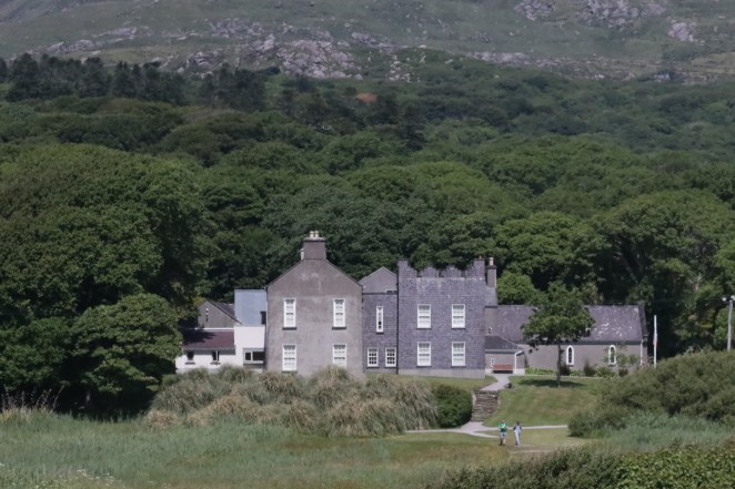 There is an entry free for the main manse, but the gardens, chapel, and some of the outbuildings are free. Start by walking the enchanting fairy trail in the garden. It is a delight for people of all ages and the most likely place for a leprechan or fairy to live.


When you’re done exploring, take the three-minute walk across the dunes to see an unbelievable turquoise sea and beaches that rival any Caribbean location. Blue skies and warm temperatures will mean a swim and nap are in order. Temptation will temporarily win the day.


After a little rest, head to the back of the beach and notice the yellow man walking posts for the Mass Path. Follow them around Derrymore bay, enjoying four beaches connected like perfect pearls between the green landscape.


In time, reach (Ahamore) Abbey Island. If the tide is out, you can walk in without getting wet. These ruins and the church yard are from the days of Saint Fionan in the 6th century. Much of the old site has been reclaimed by the sea. What exits are remains of a church with arched windows and old graves mixed with current era all around the site. The most notable person buried here is Mary O’Connell—Daniel the Liberator’s wife.


Valentia Island
Valentia is a beautiful place with plenty to explore. The lighthouse and museum at Cromwell Point is well done, explaining what life was like to live in a dangerous spot during bad storms. Follow remains of a 16th century fort while walking around the site. The Glanleam standing stone from the bronze age is located right inside of Cromwell’s star-shaped fort. I wonder what those medieval men destroyed in the process of building the military stronghold…


Geokaun Mountain and the Fogher Cliffs are the highest point of the island and there’s nice, easy walks around the hills with spectacular 360 degree views. Expect a vehicle entry fee to drive up.


")

Driving to the west end of the island, we tried finding St. Brendan’s Well (circa 486) where he baptized pagans, but it proved impossible. I believe there was a sign on the main road, but once we headed down, a chain stretched across the path. It looked as if we might be tresspassing on a farmer’s land, so we turned around. Maybe you’ll have better luck.
Keep tuned in! Next post the force will be with you at the holy island of Skellig Michael.
