I’ve lived in Montana for seventeen years and listened to friends crow about the beauty of the 27 lakes in the Jewel Basin, Flathead National Forest. I kept saying, “I’ve got to get there.” But Montana is a big state and this area is just a tick too far from my home for a day hike. Enter Covid and a loss of overseas travel to shoot The Basin to the top of my RV bucket list.
We camped at Wayfarer’s, Flathead Lake State Park, thinking that late afternoon swimming and wonderful sunsets would be an additional bonus. I suggest reservations instead of fighting for first-come-spots. It’s easy to book on-line at montanastateparks.reserveamerica.com
The Flathead National Forest Service office in Big Fork has hard maps for all the Jewel trails. It’s easier to stop and pick one up, since paths interconnect and aren’t always well marked. Alternately, there’s a map posted in the parking lot and you can take a picture of the routes with your phone. But you won’t have elevation markings.

From Big Fork, we drove past Echo lake to the Jewel Basin Road. The majority of trails in the Jewel require driving this washboard, potholed road to Camp Misery. Get there either early or later in the day but expect parking problems between 9:30-2:30. Check sunset times if you plan on going late. There is another way into the Jewel–from Hungry Horse reservoir–but prepare for a steep, hard climb in exposed terrain.
Our next decision was which trails to experience. I asked my friend, Moon National Park Travel Guide author, Becky Lomax, for recommendations for two days: Mount Aeneas and Wildcat Lake.
Mount Aeneas Summit Trail
rated: difficult (I’d call it more moderate) 6 miles out and back
Elevation gain: 1,781′
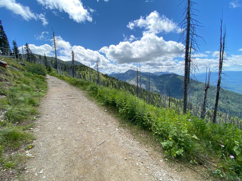

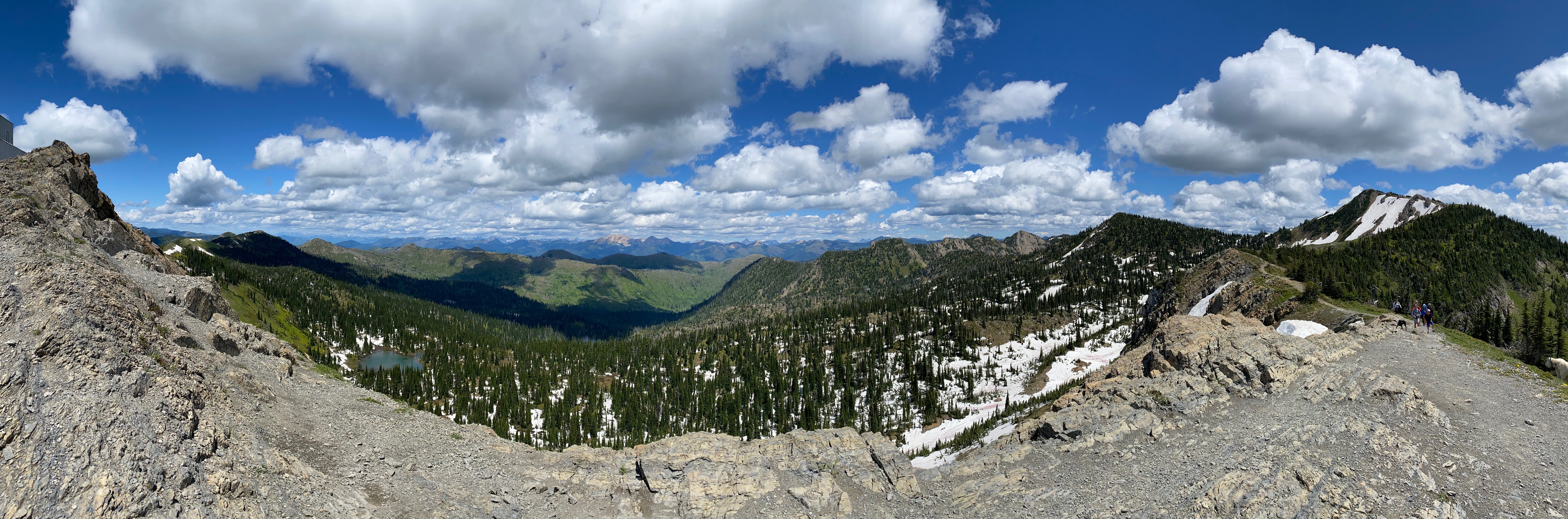
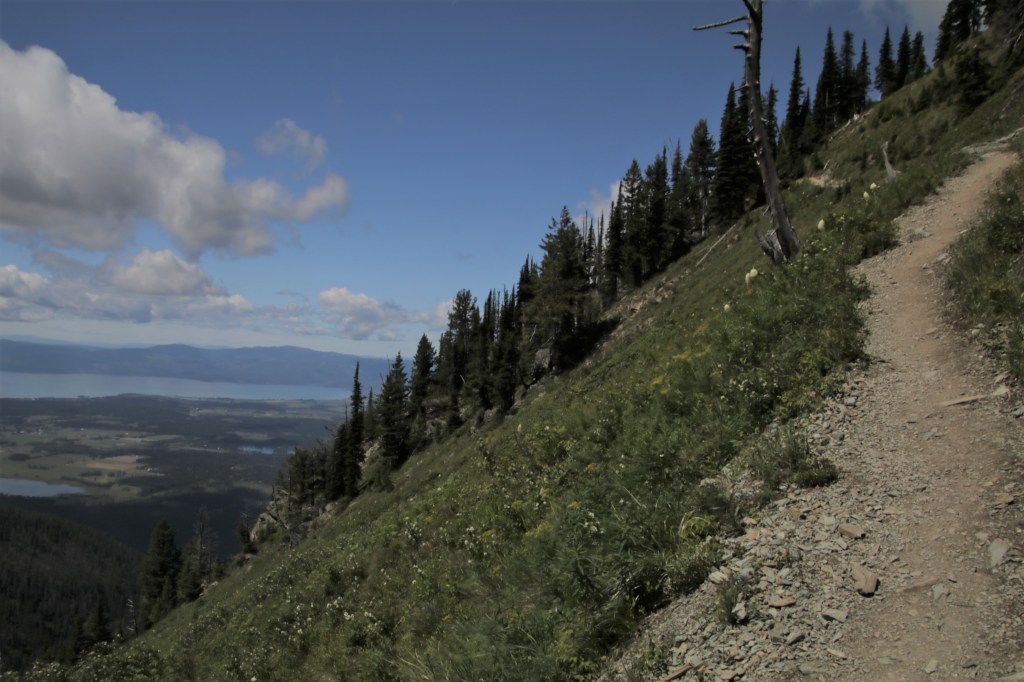
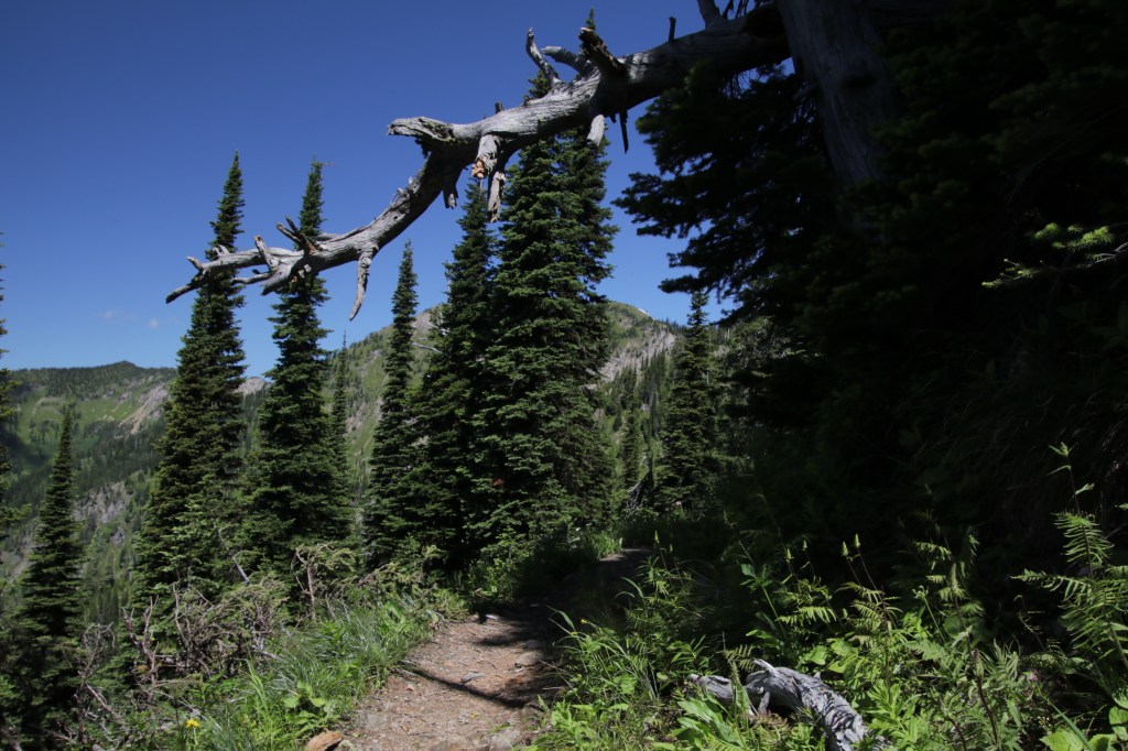
The trail starts along an old jeep trail, wide but definitely uphill at a nice grade. On the way, there are impressive views over the entire valley and Flathead Lake. Clouds seem to float just above ones head, but in reality there’s more to accomplish. (Hello? It’s named Summit Trail.) Of course it’s uphill but I found numerous switchbacks much easier to handle than mountain goat terrain.
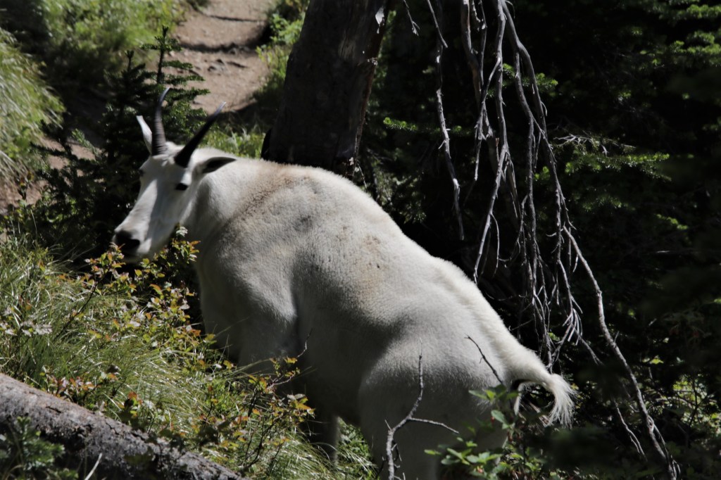
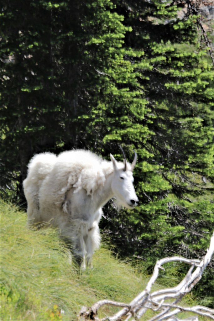

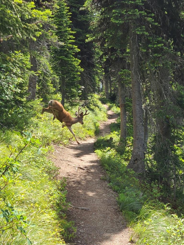
As a matter of fact, there really are many real mountain goats on this trail and they are pretty docile–not that I’d tempt fate on that one. But many people had their dogs on leashes and the goats didn’t seem alarmed by anything.
There is one meeting of trails called “dysfunction junction” where 5 trails come together and the route doesn’t seem clear. The far right trail goes down to Birch lake. The next uphill trail is the easiest one to take to Mount Aeneas.
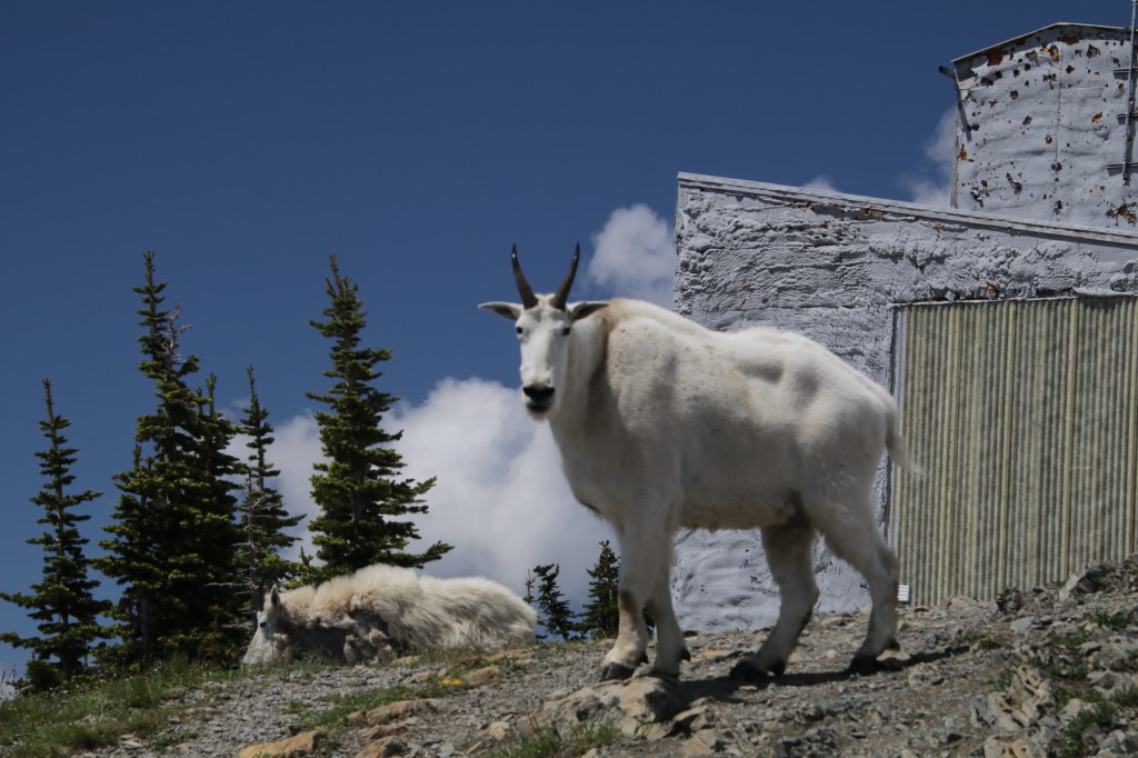

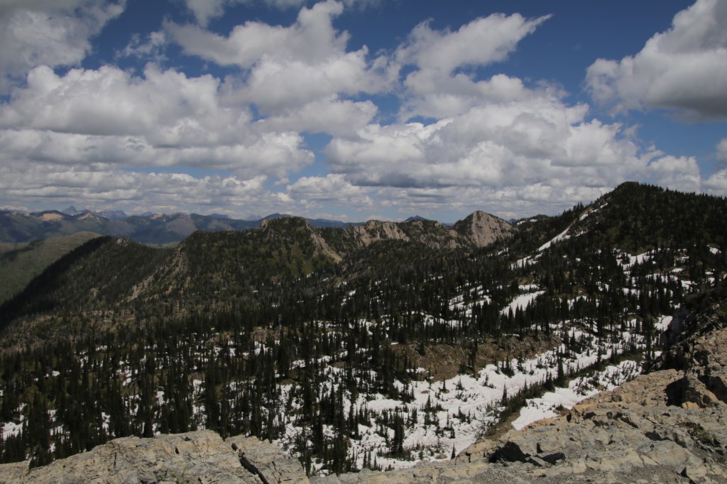
Coming up the last switchback, there’s a weather station and many goats laying around. Continue on the ridge to the top of Aeneas. There was snow still on the peak when we hiked it in July. Views are 360 degrees. Literally takes your breath away and I don’t mean from working too hard.

Wildcat Lake Trail # 8, #7 and #723
Rated: Moderate Distance: 5.2 miles +
Wildcat Lake Trail starts at the north end of the Camp Misery parking lot. There’s plenty of shade/sun mix as the trail steadily climbs uphill.
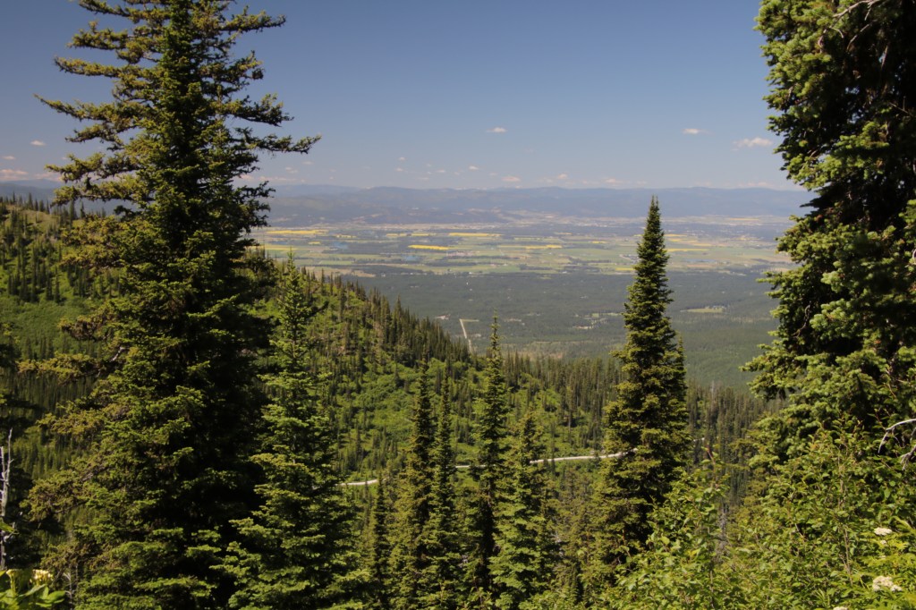

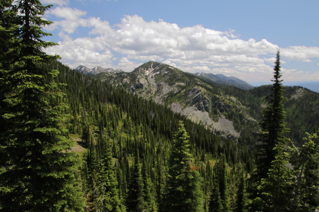
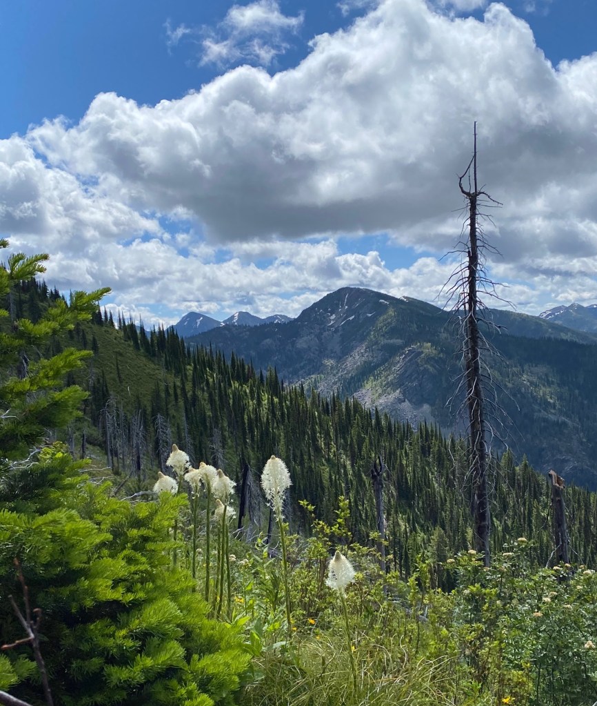
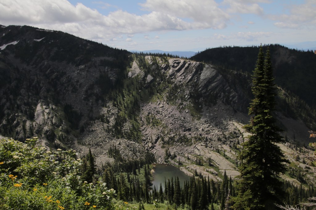
Above the trees, the views are spectacular into the Flathead Valley. Eventually, the path takes a hairpin turn, heading east. Start counting the surrounding peaks. Five of the mountains have names.
We reached a junction where trails split. To the right is #8 that loops back to Camp Misery. The middle trail heads down to two sapphire view lakes and the left trail leads to Wildcat Lake and Wildcat mountain.
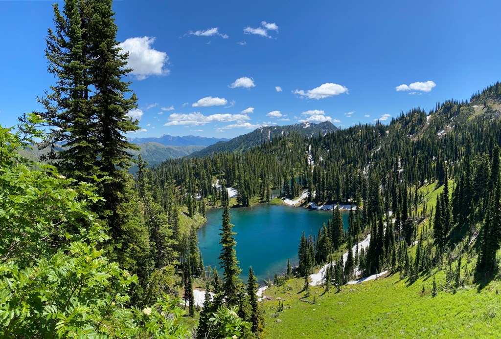
Pass the junction and you’ll begin to see twin lakes down below. In the distance are peaks of the Bob Marshall Wilderness. To the North is Glacier National Park.
When we reached 5.2 miles, the path was blocked by knee deep snow and we didn’t have snowshoes to cross. From there, the plan was to take trail #7 back so we could walk the ridge above picnic lakes. But nature had other plans when we encountered snow again and the trail was obliterated. Back-tracking we did an in-and-out on # 8,

Great pictures and narrative
LikeLike
Thank you, Peter!
LikeLike