Put yourself on a ship that navigates through a narrow opening called Neptune’s Bellows,


into the sunken caldera of an active volcano. A submerged rock lies about eight feet below the surface, smack-dab in the very middle of the channel. Bite your nails. The current is wild, and a shipwreck lies just inside the entrance as a reminder how quickly life can go bad. Red ash looks like folded curtains along the cliffs and you may see wisps of steam.


This isn’t the opening of a Hollywood thriller, this is every day drama at Deception Island, in the South Shetland chain.
The sea floor is rising as magma pushes up. and some water temperatures have been recorded at 158 degrees Fahrenheit. During eruptions in the 1960’s the water was so hot, paint melted off of ships.

hike up here and you can look down and out a “window” to the sea far below
There are so many cool reasons to experience this closely monitored site. The volcano has changed the micro-climate, allowing over 18 species of moss and lichens not found ANYWHERE else in Antarctica.Check out what it’s like to dive below the surface with the Lindbald expedition : http://www.deceptionisland.aq/flora.php
 If you were a bird, would you want to hang out where it’s warm? Of course. The world’s largest chinstrap penguin colony with over 100,000 breeding pairs are here. We also saw blue-eyed shags (cormorants) with juveniles as big as the adults, nesting high above on the cliffs. (Thank goodness for that 600mm lens!)
")
")
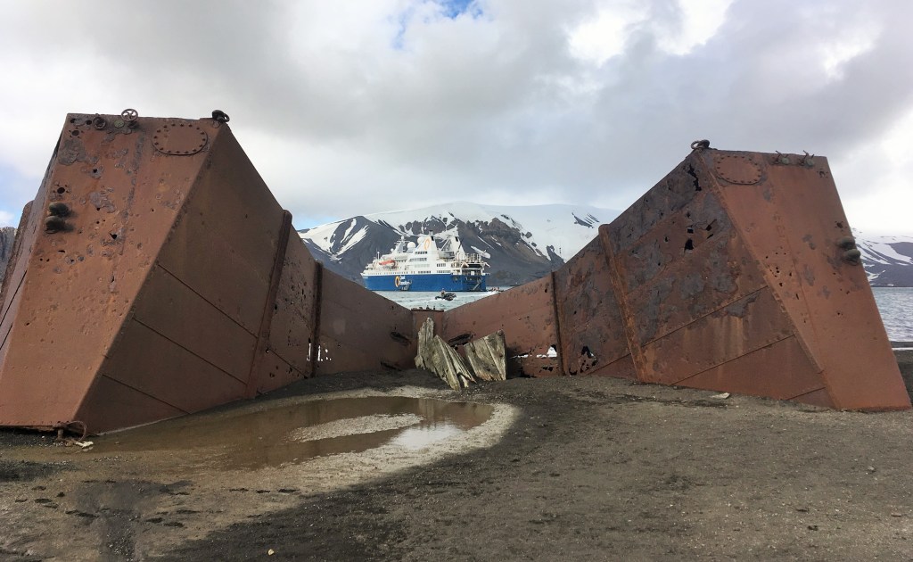
Inside the caldera is the historic site at Whaler’s Bay where ruins of oil tanks, buildings and boats from the early 1900’s sit upon a black ash beach.


Two lonely graves still haunt me. This used to be the largest cemetery (35 men buried and 10 memorials to presumed drowned) in all of Antarctica before the last eruptions. I cannot let the memory go, knowing they are so far from home. 
There’s an airplane hanger at one end. This is where the first trans-Antarctic flights began in 1928. 
During and after WWII, the British destroyed some of the whaling remains, and set up a remote military post. There was great concern that the German’s would use Antarctica for nefarious reasons. After the war, the station returned to scientific study until 1967.
On the internet there are pictures of tourists soaking in pools dug into the warm sand. This isn’t allowed anymore (Hello? Environmental impact?) and there’s discussion about reducing the numbers of ships coming here. Count yourself l-u-c-k-y if you can visit this unique historic and environmental site.


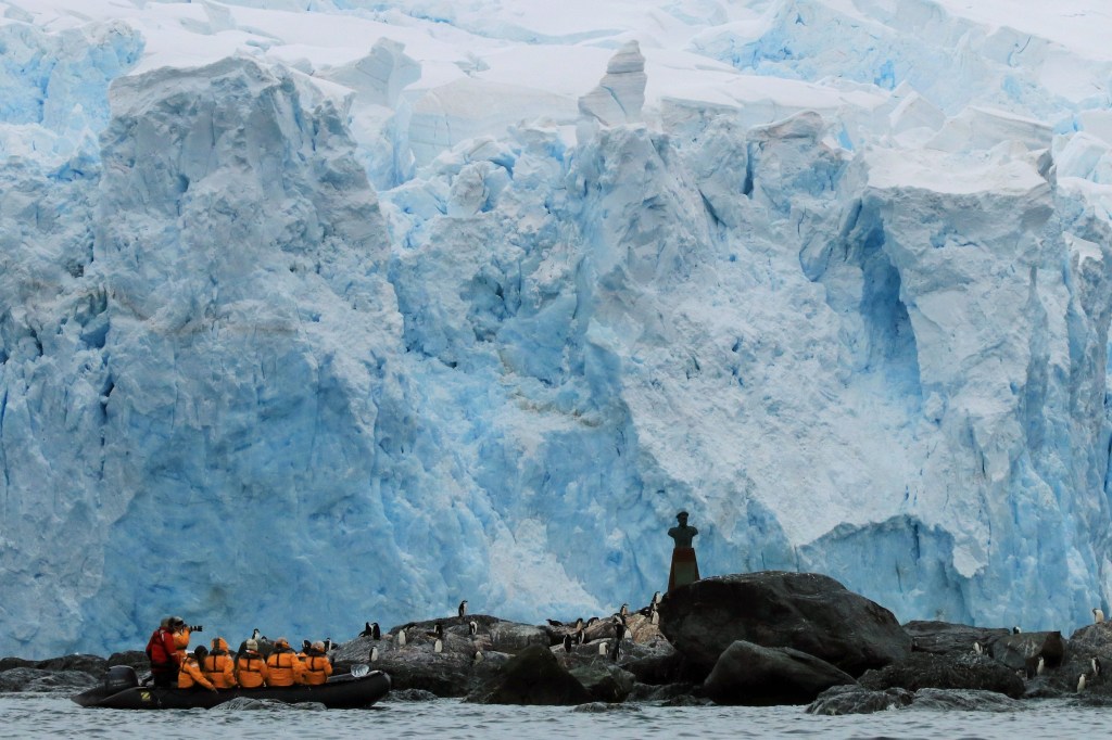
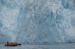 Endurance Glacier (named after the rescue) is a piedmont glacier. Do you know what that means? Did you know there are so many glaciers in Antarctica that many have never been named? Maybe your class can petition to name one. See the blue ice? This means it’s old and compressed.


